Arriving by Sea
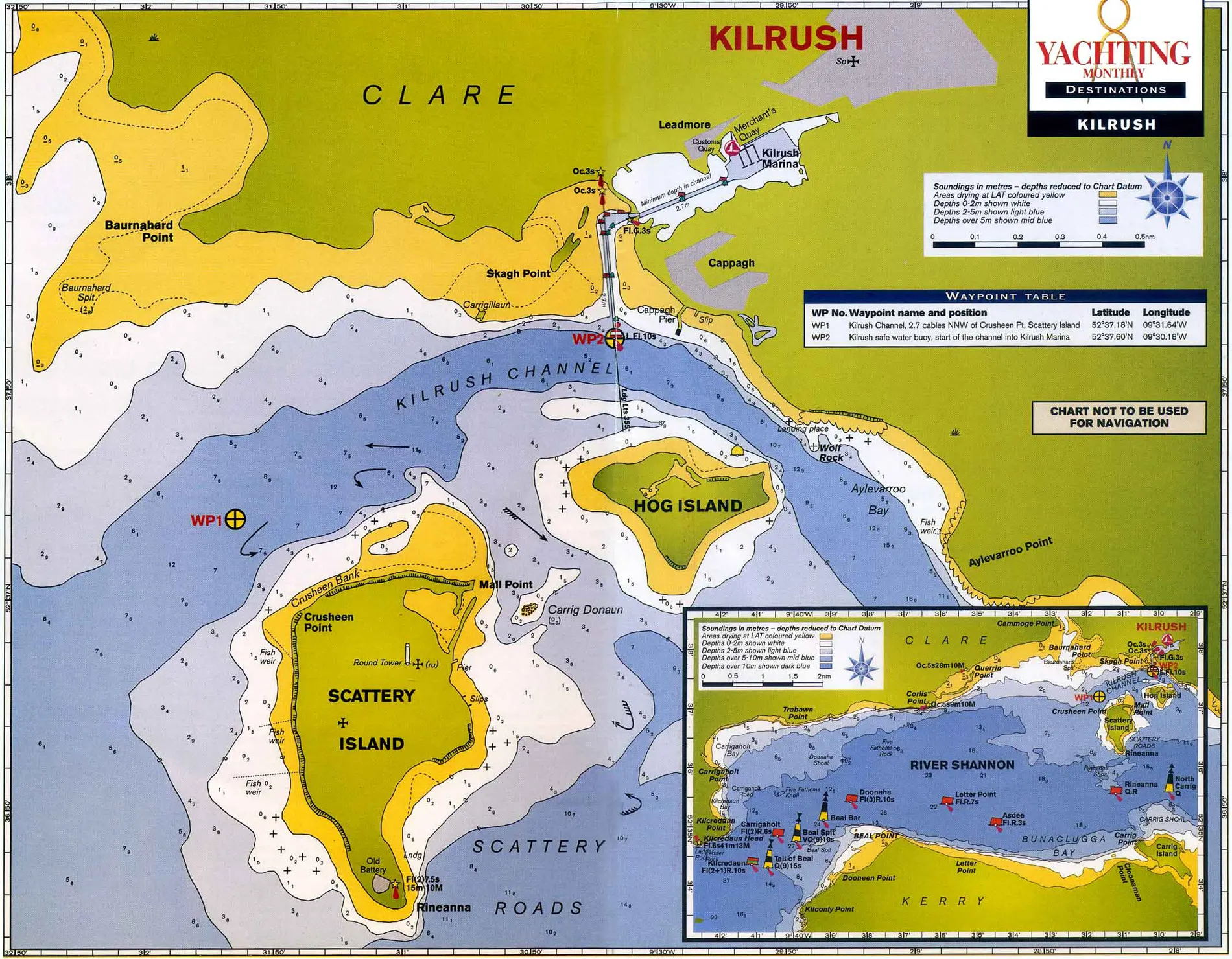
Coming in by sea the fairway buoy marking the channel is at 52.37.60 N 09.30.18 W and is situated on the Kilrush Channel between Hog Island and the mainland.
From the fairway buoy the transit the channel to the lock gates using the leading lights/diamonds on 355degT.
100m east of the Fairway Buoy is Cappa Pier, identifiable by red over red lights indicating the pilot boats tie up here.
Kilrush Marina office is open every day from 08.00 to 17.00. A staff member is on call 24 hours a day to facilitate 24 hour access. Listening watch is on VHF Ch 80 during office hours only. Alternatively contact us on 0659052072.
Tides run hard even in the outer parts of the Shannon Estuary. From a point halfway between Loop and Kerry Heads to Kilrush is 18 miles over the ground, but any yacht will knock this off in three hours or less with a fair tide and wind. Currently there is a tidal constraint on the marina access channel, allowing entry or exit 2 hours either side of low water springs.
The extensive waterway of the Shannon Estuary is 50 miles long from Loop Head,the northern point of the outer entrance,to Limerick. Its widths vary from ten miles across between Loop Head and Kerry Head ( the southern point of the Estuary mouth) and one mile wide at the narrow point of Tarbert.
Approaching from the north, the distance from the sheltered harbour of Kilronan in the Aran Islands to Loop Head is 38 miles. Although there are some anchorages for settled weather on the intervening coast, the prudent navigator should do this passage in one hop.
Approaching from the southwest, once the Blasket Islands have been cleared, the straightforward 36 mile passage to the Shannon mouth is favoured by the prevailing winds, and there are several readily available anchorages en route at Smerwick, (10 miles from the Blasket Sound), Brandon Bay (22 miles), Maharees (24 miles) or the additional diversion to Fenit (36 miles)
The latest edition of the Irish Cruising Club’s sailing directions for the South and West Coasts is essential reading for anyone cruising this region. Large scale Admiralty charts 2254 and 2173 cover the south western and northern approaches respectively. Imray chart C55 covers Dingle Bay to Galway Bay.

